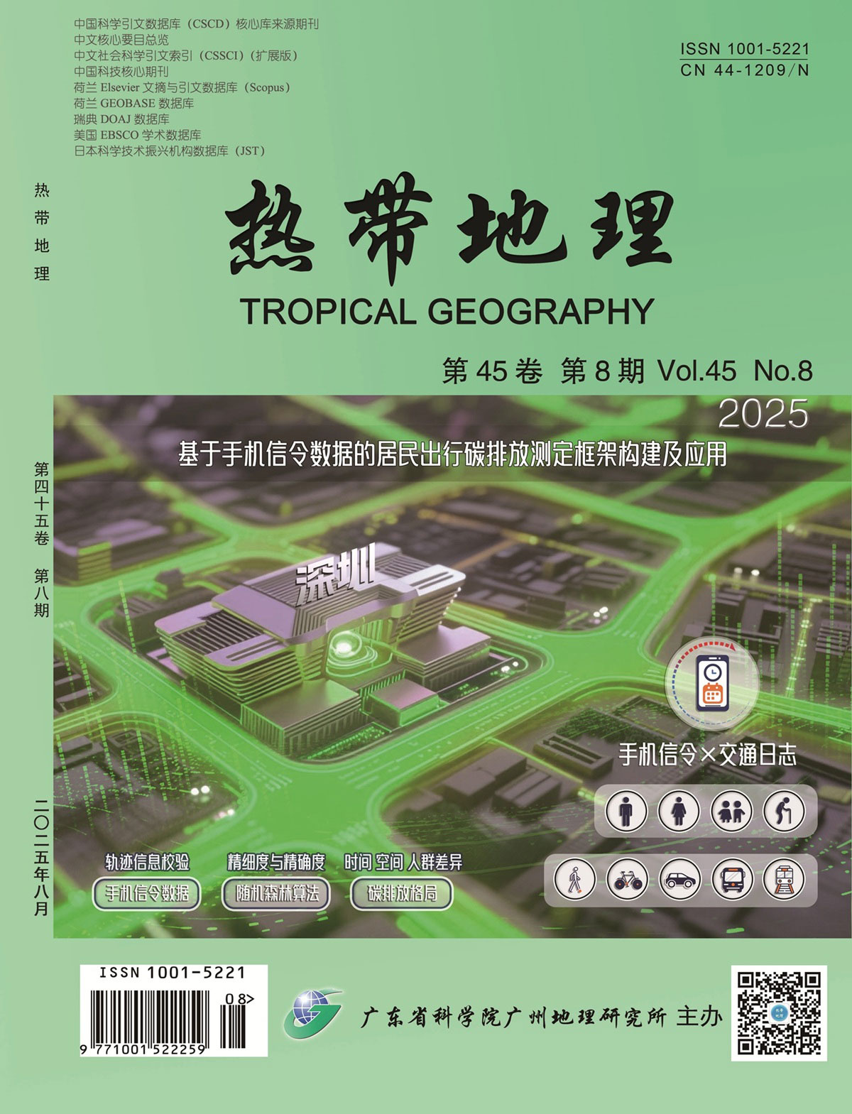
Accurately identifying the spatiotemporal characteristics of urban residents' travel carbon emissions is an important scientific issue in transportation geography and planning, and is also a prerequisite for formulating reasonable low-carbon transportation policies. Existing studies mostly use top-down methods for calculation, however, the lack of internal urban statistical data, difficulty in depicting the dynamic evolution and spatial distribution patterns of carbon emissions, and other factors, have restricted the further development of related research. Furthermore, problems such as small sample size, low accuracy, and the need to verify the effectiveness of bottom-up calculation methods have always been difficult to solve. Therefore, this study proposes a framework for measuring residents' travel carbon emissions using mobile phone signaling data to: 1) Overcome the reliance on traditional statistical data, innovatively integrating travel survey logs with mobile phone signaling data, and effectively verifying the trajectory information. 2) Extract factors influencing the travel mode choice, such as residents' social attributes, travel characteristics, public transportation service levels, and travel preferences, and uses the random forest algorithm to specifically identify five travel modes, balancing precision and accuracy. 3) Comprehensively consider factors such as travel mode, distance, speed, vehicle energy consumption type, and passenger load rate to accurately reflect carbon emissions from individual residents' single trips. 4) Aggregate by time, space, and population characteristics to multidimensionally reflect the carbon emission patterns of residents' travel. Taking Shenzhen as an example, based on the travel data of over 30 million residents, a technical application was conducted. The accuracy rate of individual travel mode identification was 77%. The aggregated carbon emission calculation results effectively revealed the highly concentrated distribution pattern of "two belts, three zones, and multiple points" and the functional spillover effect of the Shenzhen metropolitan area at the spatiotemporal level found that there were structural differentiations in traffic carbon emissions between working and non-working days, and between commuting peaks and general periods in different urban areas; at the population attribute level, the significant influence of age, gender, and other characteristics on residents' travel distances, travel modes, and travel carbon emissions were further confirmed. This framework is conducive to clearly and comprehensively revealing the spatiotemporal characteristics of urban residents' travel carbon emissions, providing new technology for high-precision monitoring of urban transportation carbon emissions and a basis for the formulation of urban transportation pollution reduction and emission reduction policies.
Investigating the spatiotemporal characteristics of how a built environment influences street-running activities is crucial for advancing public health and constructing healthy cities. However, existing research lacks a detailed analysis of the mechanisms between the built environment and running behavior, particularly from a spatiotemporal perspective, often assuming a singular linear relationship. Taking Shenzhen as a case study, this research employed various urban spatial data sources, including running trajectories, street views, and POI data, to analyze the spatiotemporal differentiation characteristics of street-running activities. Random forest analysis was used to explore the non-linear relationship and threshold effects between street-running flow and the built environment, which consists of six dimensions: natural environment, density, diversity, street design, transportation convenience, and landscape accessibility. The results indicate that (1) there are significant differences in the spatiotemporal distribution of street-running flow in Shenzhen. Temporally, residents' running behavior on the streets was characterized by distinct morning (T 05:00-09:00) and evening (T 17:00-22:00) rush hours, with the most notable activity occurring around 7:00. Spatially, the street-running flow in Shenzhen exhibited a pattern of "scattered points and continuous lines." (2) Among the variables influencing street-running flow, the distance to water, sky openness, and the NDVI had the most significant impacts. The average importance scores for these three factors across the four time-period models are 14.39%, 8.53%, and 8.30%, respectively. Conversely, the impact of transportation facility density and park or square density is minimal, averaging below 5% across the four time-period models. (3) A pronounced nonlinear relationship and a threshold effect were evident between the built environment variables and street-running flow across the four time periods. NDVI and sky openness exhibited a nonlinear positive correlation with the overall street-running flow across various time periods, with thresholds of 0.4 for sky openness. A non-linear negative correlation was noted between slope, interface richness, distance to water and street-running flow in different time periods. A complex nonlinear relationship was observed between functional density, green vision rate, relative walking width, proportion of flow safety facilities, NQPDA and street-running flow, and the impact effects of the five variables vary at different time periods. This research addresses the limitations of prior studies that primarily considered singular temporal features and single relationships when examining the relationship between the built environment and running behavior. By identifying the optimal built environment range that influences street-running flow using random forests, this study offers nuanced guidance for shaping fitness spaces and designing pedestrian-friendly streets in Shenzhen. For example, reasonably optimize the ecological space of street landscapes, reduce the inhibitory effects of street terrain and interfaces, and finely adjust street functional facilities and interface layout.
Amidst rapid motorization, urban road traffic safety has become increasingly critical. As a fundamental framework of traffic systems, road networks strongly influence the occurrence of traffic accidents. The impacts of urban road networks on traffic accidents exhibit considerable spatial heterogeneity. However, the nonlinear relationship between road networks and traffic accidents, and the moderating effect of land use, have been overlooked. We focused on the main urban area of Wuhan and used a Gradient Boosting Decision Tree model (GBDT) to explore the nonlinear relationships between road networks and traffic accidents, while also identifying the synergistic effects of land use and road networks on traffic accidents. The geometric and topological features of urban road networks generally have nonlinear and threshold effects on traffic accidents. The total contribution rate of road network characteristics to traffic accidents reached 51.2%, highlighting their key role in traffic accidents. Average geodesic distance, mesh density, and global clustering coefficient showed a nonlinear positive correlation with traffic accidents. Meanwhile, the density of the road network and the density of intersections showed a nonlinear negative correlation with traffic accidents. The assortativity index showed a nonlinear U-shaped relationship with traffic accidents. Closeness centrality, betweenness centrality, and detour rate have nonlinear effects on traffic accidents, with spatial scale differences observed at 400, 1 700, 3 000, and 7 500 m. The influence of the 7 500 m scale is greater. In terms of near centrality, there is a nonlinear positive correlation and threshold effect between near centrality at the 400 and 1 700 m scales and the number of traffic accidents. In contrast, the near-centrality at the 3 000 m scale has an approximate linear positive correlation with the number of traffic accidents. Meanwhile, the near-centrality at the 7 500 m scale has a right-biased U-shaped relationship. For the betweenness centrality, the betweenness centrality of 400, 1 700, and 3 000 m scales also showed a nonlinear positive correlation and threshold effect. However, the betweenness centrality of 7 500 m scale and the number of traffic accidents showed a U-shaped relationship. In terms of the detour rate, there is a nonlinear negative correlation and threshold effect between the detour rate at the 400 m and 7 500 m scales and the number of traffic accidents. There is a non-linear positive correlation and threshold effect between the detour rate of 1 700 and 3 000 m and the number of traffic accidents. Land use and road networks exhibit complex synergistic effects on traffic accidents. First, moderate land use mixing produces positive traffic safety benefits under the combined effects of road networks. However, when the land-use mixing degree exceeds a certain threshold, excessive mixing reduces the positive traffic safety benefits caused by road networks. Second, there was a positive correlation between floor area ratio and traffic flow. Increasing the floor area ratio may inhibit the positive effect of road network characteristics on traffic safety. However, on a global scale, traffic flow in a high plot ratio area may be more positively affected by the optimization of road network characteristics, thus reducing the risk of traffic accidents. This study used machine-learning methods to examine the nonlinear relationships between urban road network characteristics and traffic accidents. By identifying nonlinear, scale, and threshold effects, this study overcomes the limitations of traditional studies. It not only enriches the dimensions and depth of research on the relationships between road networks and traffic accidents, but also accurately identifies the thresholds of key road network indicators, providing strong support for the in-depth analysis of the driving mechanisms behind traffic accidents. This study further investigated the synergistic effects of urban land use and road networks on traffic accidents and proposed collaborative optimization strategies. These strategies offer theoretical guidance and technical support for urban road traffic planning and contribute to the enhancement of urban traffic safety.
Understanding the impact of large-scale road construction on landscape fragmentation in urban agglomerations provides a crucial scientific foundation for coordinating transportation development with the ecological environment and establishing sustainable eco-transportation infrastructure. This study focuses on the Guanzhong Plain Urban Agglomeration (GPUA), a rapidly developing urban cluster in the middle reaches of the Yellow River Basin that has experienced accelerated expansion of high-speed transportation networks. Building upon an analysis of landscape fragmentation patterns, we measured the differential impacts and spatial variations of various road types on fragmentation, offering new insights into the spatial complexity of road network disturbances in regional landscape patterns. Using 2020 highway network and land-use data from the GPUA, we implemented a Geographically Weighted Neural Network Regression (GNNWR) model to systematically investigate geographic patterns of road-induced landscape fragmentation while accounting for non-linear relationships and spatial non-stationarity. This approach further revealed how distinct road types contribute to fragmentation with varying spatial effects. The results demonstrated that, compared with traditional Geographically Weighted Regression and Ordinary Least Squares Regression models, the GNNWR model more accurately captured the influence of roads on landscape fragmentation and spatial heterogeneity. Landscape fragmentation across the study area exhibited a distinct core–periphery differentiation pattern, generally remaining at low levels dominated by low- and medium-low value zones, with striking spatial contrasts emerging between clustered low-fragmentation areas in urbanized plains and highly fragmented mountainous ecological zones. Road hierarchy showed a positive correlation with fragmentation intensity, though expressways exhibited limited impact due to semi-enclosed management systems. Low-grade roads had the most substantial influence on fragmentation in terms of patch dimension and spatial distribution dimension, while high-grade roads significantly affected fragmentation across all dimensions. Notably, the spatial heterogeneity in natural ecological baselines and intensity of human activity drove context-specific interactions between transportation corridors and landscape patterns. These dynamics established distinct spatiotemporal logics within ecological barrier zones, agricultural matrix areas, and urban expansion zones, where road networks interacted with local landscapes through geographically differentiated mechanisms.
Rapid urbanization in China has significantly exacerbated light pollution, disrupted the ecological balance, and imposed constraints on both astronomical observations and public access to stargazing. Therefore, addressing light pollution has become a critical issue in ecological conservation and sustainable development. Shenzhen's Xichong Community achieved a landmark milestone in 2023 by becoming China's first International Dark Sky Community certified by the International Dark-Sky Association (IDA). This designation makes light pollution control practices of Xichong significant for similar regions. This study aimed to systematically evaluate the effectiveness of light pollution control measures in the Xichong Community, providing a scientific basis for balancing conservation and development in comparable areas. This study innovatively utilized high-resolution nighttime light (NTL) remote sensing data acquired using the Sustainable Development Goals Satellite-1 (SDGSAT-1), integrated with NASA's Black Marble products, to establish a refined monitoring and assessment framework for light pollution. To address the challenge of radiometric inconsistencies inherent to multitemporal SDGSAT-1 NTL imaging, this study proposed a novel radiometric consistency correction method based on Random Forest Regression (RFR). During the preprocessing phase, the images were subjected to salt-and-pepper noise removal and absolute radiometric calibration. Subsequently, the RFR model was applied to achieve a radiometric consistency correction. A comparative analysis with traditional linear brightness normalization confirmed the superior accuracy and effectiveness of RFR approach in enhancing image comparability. By leveraging corrected, high-quality, time-series NTL imagery, this study quantitatively assessed the effectiveness of light pollution control measures implemented in the Xichong Community over a three-year period. The key findings were as follows. (1) Significant reduction in light pollution: the Xichong Community exhibited a markedly greater decline in overall light pollution intensity compared to other areas within the Dapeng New District. Pixel-level analysis verified the widespread nature of this decreasing trend, with the brightness values showing a pervasive reduction. (2) Effective control across functional zones: the core stargazing beach area witnessed a substantial brightness reduction (57%) in September 2024 compared with that seen in September 2022. Road-lighting intensity also decreased significantly (56%-70%). Among the residential zones, Xinwu and Xiyangwei villages achieved reductions exceeding 69%, whereas brightness in Nanshe village decreased by 55.7%. Getian and Xigong villages experienced steady declines, while Hesou, Yashan, and Shagang Villages saw fluctuating but overall decreasing trends. (3) Effective management of light pollution sources: although accommodation facilities remain the primary contributors to light pollution, their brightness coefficients decreased significantly (46.11%). Points of Interest (POIs) related to tourism saw reductions exceeding 45% in brightness, with overall POI brightness coefficients declining by 27.68%-74.45%. These results demonstrate that the stringent lighting management policies implemented by the Xichong Community effectively mitigated the adverse impacts of tourism development on the dark sky environment. This study not only successfully applied high-resolution NTL data from SDGSAT-1, but also developed an RFR-based radiometric consistency correction technique, significantly improving the comparability of multi-temporal NTL data. The established methodological framework enables fine-scale monitoring of nighttime lighting at the community level, specifically for areas pursuing "dark-sky conservation + ecotourism" models. Furthermore, this study provides a foundation for establishing a dynamic monitoring and quantitative assessment system for light pollution within existing dark-sky reserves. These advancements offer critical scientific foundations and technical support for balancing the imperative of dark-sky conservation with sustainable tourism development goals.
With rapid societal development, economic growth, industry, agriculture, and human activities, large amounts of sewage rich in nitrogen, phosphorus, and other nutrients are produced. This causes eutrophication in lakes and reservoirs, leading to frequent algal blooms that pose a serious threat to aquatic ecosystem stability and drinking water safety. Chlorophyll-a (Chl-a) concentration, a core indicator of algal biomass and the degree of eutrophication in water bodies, correlates positively with algal bloom outbreaks. However, Chl-a concentration variance under the influence of multiple factors displays highly nonlinear characteristics. Traditional prediction models are unsuitable for relationship analyses between environmental factors, generally producing low prediction accuracy with weak applicability. To address this challenge, we proposed a short-term chlorophyll a concentration prediction method based on multi-scene segmentation, and constructed a prediction model with enhanced adaptability by recognizing the characteristic laws of different environmental scenarios to improve the accuracy of Chl-a concentration prediction. By analyzing the laws influencing various factors, we proposed three partitioning strategies: 1) factor interaction and scene partitioning by analyzing connections between key environmental factors and adopting K-means method to partition these scenes. 2) diurnal difference scene partitioning based on diurnal cyclicity of algal physiological activities, dividing the data into two scenarios, and 3) trophic state scenarios, based on Trophic Level Index. A water body is divided into three trophic categories: anaerobic, mesotrophic, and eutrophic. Three machine learning models (Random Forest, Gradient Boosting Decison Tree, and eXtreme Gradient Boosting) using multi-scenario classification and a linear regression model were each adapted to perform short-term prediction of Chl-a concentration. The multi-scenario partitioning strategy proposed in this study substantially optimized model prediction performance. Factor interaction scenario partitioning yielded the best prediction results, with an overall RMSE(Root mean square error) prediction average of 0.004 5, improving prediction accuracy by 4.26% compared to that of the unpartitioned scenarios. Overall improvement in prediction accuracy from diurnal and nocturnal scenario partitioning was limited. Its overall RMSE prediction average was 0.004 74, improving prediction accuracy by 0.9%. In eutrophic scenario, the four prediction models (RF, GBDT, XGBoost, and linear regression) exhibited respective RMSEs of 0.003 4, 0.003 6, 0.003 5, and 0.003 9, with RF model giving the highest prediction accuracy. In summary, we propose an innovative short-term prediction model to improve the accuracy of low Chl-a concentration predictions in complex situations, providing a new paradigm for intelligent modeling and precise governance. The data obtained using a multi-scenario delineation system revealed the dynamic coupling mechanisms between the diurnal biological rhythms in a water body, nutrient grading, and the interaction of water quality factors. The idea of this study effectively solves the problem that the traditional prediction model can not meet the current prediction needs. This study can provide a systematic analysis for the prediction of cyanobacterial bloom, and can provide technical reference and theoretical support for the multi scenario prediction of Chl-a concentration.This study not only clarified the driving law of Chl-a concentration change under different scenarios, but also promoted the transformation of simplifying the analysis of complex problems of water environment, providing a new perspective for the mechanism research of complex water environment system.
Total Nitrogen (TN) refers to the total amount of various forms of inorganic and organic nitrogen in a water body. At present, global rivers draining into the sea are facing the problem of exceeding TN standards. Evidence suggests that TN in a basin is directly affected by land use. National and local governments attach great importance to the TN reduction projects in the Pearl River Basin. The Beijiang River Basin is an important part of the Pearl River Basin. Therefore, exploring the temporal and spatial distribution characteristics of TN concentrations and revealing their correlation with land use are of great significance to the health of the aquatic environment in the Beijiang River Basin. Based on sentinel-2 MSI multispectral remote sensing data, combined with synchronous data from 59 automatic water quality monitoring stations in the basin, and by analyzing the correlation between TN monitoring data and band combination, this study constructed a random forest TN remote sensing inversion model and analyzed the temporal and spatial variation of TN in the basin from 2019 to 2023. In addition, the land use data from 2019 to 2023 released by the Environmental Systems Research Institute (ESRI) were collected. The Pearson correlation coefficient was used to conduct a single-factor correlation analysis between TN and various land-use types at different spatial scales, and the impact of land-use spatiotemporal change on TN in the watershed was discussed. The prediction effect of the random forest TN remote sensing inversion model was good, R 2 was 0.75, root mean square error was 0.42 mg/L, and the model was suitable for the inversion of watershed TN. From 2019 to 2023, the TN concentration in the basin exhibits a downward fluctuating trend. The average concentration of TN was the highest in 2021 and lowest in 2023. The TN concentration increased from the upstream basin to the estuary. The high-value area of TN in the upstream basin was located in the mainstream section, the high-value area of TN in the midstream basin was located in the Changhu reservoir on the Yongjiang River, the high-value area of TN in the downstream basin was located in the Shujiang River section, and the high-value area of the delta basin was located in the Guangzhou section of the Pearl River. The TN concentration was found to have different correlations with different land-use types at different spatial scales. It had significant correlations with agricultural land and grassland at small spatial scales and with forest land and building land at large spatial scales. The proportion of forest land area from the upstream to the downstream basin was the highest, and the proportion of agricultural land area was similar to that of construction land. The delta basin had the highest proportion of construction land, which is much higher than that of forest and agricultural land. From 2019 to 2023, the proportion of agricultural land in the basin decreases annually, the degree of urbanization increased annually, and the source of TN gradually changed from agricultural to domestic and industrial sources.
Offshore aquaculture is an important marine economic activity; however, unreasonable aquaculture practices have led to the deterioration of the marine ecological environment. Dissolved inorganic nitrogen (DIN) and active phosphate (PO4) are important indicators for characterizing the health status of aquaculture areas, and chlorophyll a (Chl-a) is a key indicator of the biomass and eutrophication status of phytoplankton. In this study, the coastal zone of the Beibu Gulf in Guangxi Province was selected as the study area, and Sentinel-2 and Landsat-8 satellite images and water quality data were collected from 2014 to 2022. The spatial distribution characteristics of the aquaculture area were extracted using the kernel density method. A water quality remote sensing inversion model based on random forest was constructed, which had good prediction accuracy in the offshore low concentration area. The R² value of the model was 0.739-0.882, Approximately 70% of the water quality inversion results achieved R² values exceeding 0.8, and the fitting degree was high. The prediction performances for DIN, PO4, and Chl-a were excellent, and the R² values of the validation set were 0.858, 0.882, and 0.872, respectively, indicating the stability and reliability of the model on different datasets. The prediction results in the scatter plot are close to the y = x line, indicating that the model better reflects the overall trend between the measured and predicted values. Both the RMSE and MAE values were low overall, ranging from 0.003 to 1.722, which is appropriate for remote sensing inversion of nutrient concentration and chlorophyll a concentration in the coastal waters of the Beibu Gulf, and better fits the nonlinear relationship between nutrient concentration and remote sensing reflectance data. This not only verifies the feasibility of machine-learning methods in remote sensing monitoring of water quality, but also provides an efficient and low-cost technical means for future water environment monitoring. The results showed that the intensity of aquaculture activities in Beibu Gulf has been increasing in recent years. Through the analysis of seasonal changes in water quality of the coastal waters of Beibu Gulf in 2022, it was found that there were significant temporal and spatial changes in the impact of aquaculture activities on water quality in different seasons and regions, and the concentrations of inorganic nitrogen and active phosphate in the high-density aquaculture area during summer were significantly higher than those in other regions. Based on the data analysis of the coastal zone of Beibu Gulf from 2014 to 2022, changes in water quality indicators (such as PO4) in the high-density aquaculture area showed an upward fluctuating trend and the water quality of that area showed a potential degradation trend. The results of this study provide a scientific basis for the prevention of pollution and environmental management in coastal aquaculture.
Protected area is a crucial spatial concept in contemporary human geographical research. Previous research concerning human-wildlife relationships has predominantly focused on pragmatic frameworks such as wildlife population management strategies or post-conflict compensation mechanisms. However, the "emotional turn" concept in human geography points out that research on human-animal interactions must not overlook the affective interactions between humans and animals that occur within specific places. Therefore, this study selected the Mengyang Sub-Reserve in the Xishuangbanna National Nature Reserve, China, to investigate the underlying factors influencing human-wildlife interactions within protected areas,. Drawing on the core concept of "animals' atmosphere," it explored human-wildlife interactions across multiple spatiotemporal dimensions and the generation and evolution of affective atmospheres. This study employed comprehensive qualitative methods, including participatory observation and textual analysis. The main findings are as follows: (1) In the pre-modern era, the subjectivity of Asian elephants was reflected through cultural representations, such as historical allusions and mythological legends, which mapped the affective experiences of local residents and focused on reverence and admiration. These affective experiences have established the emotional foundation of the human-elephant relationship since ancient times. However, since the modern era, economic development, transformations in the material environment, and community relationships have reshaped the lifeworld of Asian elephants. Phenomena, such as habitat destruction and poaching, have led to a predominantly negative atmosphere between humans and elephants. (2) The introduction of modern tourism and conservation activities have meant that the subjectivity associated with Asian elephants is exercised in non-representational ways within different interaction contexts: For example, scenic areas manipulate the interactions between humans and non-human animals by reshaping tourist spaces where tourists discern the subjectivity of Asian elephants through the act of gazing. Asian elephants continuously adjust their interactive approaches toward local residents through bodily gestures and accumulate survival capital through contestation and negotiation within specific spaces and times. Additionally, conservation rangers establish deeper emotional connections with Asian elephants through specialized zoological knowledge. (3) Although scenic areas manipulate tourist sentiment by creating material environments, there is often a friction between tourism operations that cater to modern tourism experiences and wild elephant survival patterns. Humans and Asian elephants constantly construct their comfort zones through mutual negotiation and compromise. In summary, this study reinvestigated the affective networks between humans and animals from a "more-than-human" perspective. It utilized the concept of the "animal atmosphere" and elucidated the intrinsic logic between conservation and development within protected areas. The findings emphasize that affective logic can still be used to uniquely interpret cross-species relationships within these coexistence spaces and provides a geographical explanation that can improve understanding about the harmonious coexistence between humans and nature. Moreover, this study analyzes the relationship between wildlife conservation and local development from spatial and affective perspectives. It addresses previously inadequate research on the differences in agency among multiple actors, responds to contemporary new animal geography requirements to explore animal agency across diverse spatiotemporal contexts, and provides concrete empirical results within a distinctive Chinese context. Finally, the study suggests that future research should engage more extensively in dialogue with disciplines such as animal ecology and ethology and should shift its focus towards more concrete tourism contexts to analyze the applicability of the theoretical concept of "animal atmospheres" across different scenarios.
As the only large mammal in Baiyun Mountain Scenic Area, Muntiacus vaginalis is a critical part of that forest ecosystem. Their activity rules and habitat adaptability are the basis of assessing the population status. As an effective method, infrared camera technology has been widely used in wildlife research. Placing infrared cameras for more than one year can help obtain the activity pattern of terrestrial birds and animals. Twenty-three infrared cameras were set: seven at an altitude of 200-300 m, eight at 100-200 m, and eight below 100 m, covering every region in Baiyun Mountain Scenic Area. Relative Abundance Index (RAI), trap occurrence, and time-period activity intensity index were used to compare and analyze the difference in activity rules, and a one-sample T-test was used for data conformed to a normal distribution. M. vaginalis was found to maintain a high activity frequency at mountaintop throughout the year but prefer to inhabit foothills during the dry season and hillside during the rainy season. The seasonal activity presented a vertical migration. The daily activity rhythm of M. vaginalis was bimodal, with peaks appearing at T 06-08 and T 17-19. Six flock types were recorded and male-female ratio was 1.17. Female with male and mixed flocks were considered as reproduction flock. The RAIof reproduction flocks showed no significant difference between dry and rainy seasons; the curves indicated thatmating behavior occurred intensively in spring and autumn, and nurturing mainly occurred in autumn. Interference drive activity did not occur in autumn, but reproduction drive activity occurred all year. Male's and female's daily activity rhythm during dry and rainy seasons had the same trends of change; however, activity rate throughout the time period was more evenly dispersed during the dry season. Relative abundance of activity at night had a significant difference between time periods (t=12.918, P<0.05). Two sources of interference have been identified, namely domestic cats and humans. The occurrence rate of cats was 68.75%, and valid photoswere grouped by the presence and absence of cats; a one-sample t-test showed that the activity of cats made no significant difference to the number of valid photos of M. vaginalis (t=0.83, P<0.05) and the number of species (t=0.931, P>0.05), which made a significant difference to the number of valid photos excluding M. vaginalis (t=2.312, P<0.05). With tourists increased in number, fewer photos of M. vaginalis were taken. Unlike nature reserves and forest parks, Baiyun Mountain Scenic Area has serious human interference. Wild animals' behaviors adapt to the environment, thus changing their activity rhythm. According to the research on Lynx lynx and Canis lupus, large mammal activity shifts to nocturnal as human activity increases and the overlap time with human activity decreases when the frequency of human occurrence increases. M. vaginalis preferred foothills, with more paths and proximity to the residential area, during the dry season, and their activity at night increased as well. During rainy season, M. vaginalis preferred hillside and daytime activity increased. Contrary to the research in Hainan, M. vaginalis in Baiyun Mountain Scenic Area liked to occupy a higher altitude. This may be due to the difference in intensity of human interference between nature reserve and scenic area. Only 39 photos of M. vaginalis cubs were captured, accounting for 1.07% of the total, which was less than the proportion of M. vaginalis cubs (9.92%) in Datian National Nature Reserve. It is speculated that the population density of M. vaginalis in Baiyun Mountain Scenic Area is higher than that in the national reserve, adult individuals were photographed more repeatedly because of their greater ability to move.
City serves as a medium for communication and, in turn, reshapes the city. Since the 21st century, social media has rapidly spread worldwide, providing users with a platform for self-presentation and channels for expression. This has greatly changed people's lives and exerted a substantial influence on the reconstruction and gentrification of urban social spaces. However, few studies have focused on the underlying mechanisms. To gain a deeper understanding of the role of social media in commercial gentrification, Nantai Alley, a renowned Internet-famous block in Nanjing, was selected as a case study, and Xiaohongshu (Red note), whose main active user group is young women, was chosen to represent social media. This study conducted an in-depth analysis of the occurrence process, formation mechanism, and comprehensive effects of commercial gentrification under social media intervention. The research found that social media is deeply involved in the commercial gentrification process and continuously promotes the gentrification process through media information dissemination. Social media involvement in commercial gentrification is mainly achieved through two types of entities: merchants and consumers. On the one hand, social media provides merchants with replicable Internet celebrity aesthetics and business models and serves as a platform for self-marketing, increasing the probability of occurrence and promoting a more simplified and rapidly evolving trend of gentrification. On the other hand, consumers, engage in trendy check-ins and act as "discourse investors," accelerating commercial gentrification. Social media's representation of urban space amplifies and reinforces commercial gentrification; the progression and outcomes of gentrification are magnified on social media, occupying its central discursive spaces, whereas the daily lives and consumption practices of local residents are marginalized and rendered invisible in these digital representations. Furthermore, the profit-driven behaviors of certain local residents have laid the groundwork for gentrification, and the government has further consolidated the achievements of gentrification through urban renewal plans. The comprehensive effects triggered by commercial gentrification present significant dual characteristics: it exerts positive effects, such as commercial revitalization and beautification of the built environment, while also generating negative impacts, such as commercial exclusion, displacement, and cultural distinction from the neighborhood. Therefore, in future urban renewal processes, it is imperative for the government to intervene in a timely manner to preserve the community's original public value orientation and sense of place. This study enriches research on gentrification in the digital age by incorporating the factor of social media, and provides references for the renewal and management of urban space in the context of stock development.
In the era of the deeply mediated internet, cyberspace has evolved into a field of human activity and practice that is as important as physical reality. However, theoretical explorations and empirical research on how cyberspace dynamically shapes, reconfigures, and even produces real spaces remain weak. This study takes the special cultural phenomenon of famous writer and artist Mu Xin (1927-2011) as an entry point to explore the generation and spatial effects of his atypical "literary icon" as a person who became famous overseas and returned to China in his later years but became "popular" in the mainland cyberspace. The study is based on Edward Soja's "third space" theoretical framework, which views cyberspace as a "third space" of ontological significance full of power games and social construction. Using a combination of online and field research, this study analyzed how Mu Xin, who became famous overseas, was shaped into an atypical "netizen" by the cyberspace in the mainland, and how he transposed from the cyberspace to the real space and played a unique role in the evolution of the real space in Wuzhen. The findings suggest that: firstly, five subjects of power in cyberspace made Mu Xin a "literary icon" that resonates with the general public, and this power will further reconfigure the real space associated with him; secondly, the influence of cyberspace on real space includes geographic reconfiguration, power reconfiguration, and poetic construction. Third, the power of cyberspace to transform real space lies in the imaginative space constructed by people with poetic colors, as well as in the economic and brand value of literary icons. Overall, this study strongly argues for the subjectivity of cyberspace in the production of space in contemporary society. Cyberspace is no longer just a virtual reflection or accessory of real space but a dynamic and productive space with its own logic, capable of profoundly and multidimensionally reconfiguring the real space associated with it through complex symbolic practices, power operations, and collective imaginaries. The research significantly expands the boundaries of the application of the "third space" theory in the digital age, effectively transferring its core insights to the analysis of cyberspace, and revealing how cyberspace, as a "third space," is specifically involved in the "spatial production" of real space. In addition, it reveals how cyberspace as a "third space" is specifically involved in the "spatial production" of real space. Concurrently, this research deepens the exploration of media geography and empirically demonstrates that cyberspace is not only a carrier of spatial representation but also a key field and driving engine of spatial production.
Since the beginning of the 21st century, the scale of global refugees has remained high, and disorderly refugee flow has seriously endangered regional security and development. Based on the forced displacement flow database of the UNHCR, this study explored the spatial process of refugee flow using temporal sequence and social network analyses. It introduces the "structural hole" theory and uses the "intermediary person" analysis method to explore the characteristics of refugee flow path transshipment. Based on the "extended population push-pull theory," a gravity regression model is constructed to explore the driving factors of refugee flow. The study findings are as follows: 1) From a global perspective, the spatial process characteristics of refugee flow present spatial limitations, regionalism, and globality, which are the result of dynamic interactions at multiple spatial scales. Specifically, refugee flow has shifted from "neighbor country diffusion" in the initial stage to "extraterritorial diffusion" in the later stage. In the initial stage of refugee flow, refugees mainly diffused to neighboring countries and countries within the region, presenting a significant regional conjugation feature. Over time, the distribution of the origins of refugees and the direction of flow showed a global trend. The regionalization of refugee flow is a prerequisite for globalization, resulting from the continuous development of regionalization; 2) The "path transshipment" effect nodes are not usually high-value nodes of intensity centrality. The space is distributed around important routes or "crossroads" on various continents, regulating the flow of refugees within and between their subgroups and having complex and multiple refugee inflow and outflow phenomena. Their refugee policies often affect other countries, both within and outside the region, by influencing the refugee flow; and 3) The driving factors of refugee flow have dynamic characteristics because of the different causes of refugee outflows in different periods and regional heterogeneity. Unlike the migration factors of general immigrants, refugees are more likely to choose to leave due to unfavorable conditions in their countries of origin, and the attraction of destinations is relatively limited. The spatial process and path transshipment of refugee flow present significant differences at different spatio-temporal scales, which is the result of the combined action of "pull force," "push force," and "friction force." This study pays attention to the perspectives and subjects that are not considered in existing research, and thus starts from the macro perspective of the global dimension, divides the temporal characteristics, and focuses on the analysis of the three subjects of "origin country, transit country, and destination country," especially emphasizing the discussion of the "transit country" of refugees. This study clarifies the general laws of current refugee flow through the above approaches and provides a reference experience for global refugee governance.
With the increasing prominence of global food security issues, strengthening the study of major food-trading countries is becoming increasingly important. India, which relies on its abundant food resources, is a major food export trade country. Food export has become an important aspect for India to strengthen its foreign trade and connections and establish its geostrategy. Therefore, there is an urgent need to intensify the research on India's food export trade and geostrategies. Based on the Food and Agriculture Organization food production, consumption, and trade data (2000-2021), a complex network was first used to analyze the characteristics of India's food trade network, which creates trade dependence on the premise of India's supply and other countries' demand. We then used interdependence theory to analyze the degree of food trade dependence between India and other countries. Based on this, India's geostrategic connotations as embodied in the food trade are discussed in depth. The results show that: (1) India has strong food production and export capacity, especially as the world's largest rice exporter. India's food trade network is gradually expanding and its position and influence on the global food trade network are constantly increasing. (2) Regarding the interdependence of food trade between India and other countries, the destinations of India's food exports are primarily distributed across South Asia, West Asia, West Africa, and other regions. The pattern of its food export trade shows that India is the center, gradually moving from its neighboring countries to regions with a long geographical distance. India's food export trade dependence on other countries shows a downward trend. The dependence of other countries (especially South Asia, East Africa, and West Africa) on India's food import trade has gradually increased, forming an asymmetric interdependence between these regions and India in the food trade. (3) Leveraging the interdependence as embodied in the food export trade, India is advancing its geostrategies. By implementing the "Neighborhood First" strategy, India has strengthened its dominance in South Asia, and used neighboring countries as a link to influence the "Greater Periphery." At the same time, in view of the "Greater Periphery," India has deployed "Act East," "Link West," "Control South," and "Connect North" policies, thus forming an all-round geostrategic pattern of "Four in One." Furthermore, using the "Greater Periphery" as a link, India continues to expand its economic and trade relations globally. Based on a comprehensive consideration of geostrategy, India has positioned the food trade as a key geostrategic tool. Through its growing food export trade, India has exchanged overseas resources, expanded its foreign economic and trade cooperation, and strengthened its international influence. This article aims to provide insights and references for the food trade and security of relevant countries and for the promotion of China's "Belt and Road" Initiative.