The identification and monitoring of outbreak points on a local scale is a challenge in the study of Mikania micrantha invasion. In this study, orthophoto images of the research area were acquired by using a red, green, and blue (RGB) camera mounted on an unmanned aerial vehicle (UAV). Three methods, including band math, image segmentation, and deep learning, were tested in order to identify the blooming point of Mikania micrantha. Results showed that high-resolution RGB mosaic images could be directly used to visually identify Mikania micrantha outbreak points. Neither the over-green index (EGI), normalized over-green index (NEGI), blue-green differential index (BGDI), green-red differential index (GRDI), normalized green-red differential index (NGRDI), nor Plant Pigment Ratio index (PPR) could separate Mikania micrantha from its host plants. Though it should be noted that PPR could provide parameter support for multi-scale segmentation. Object-oriented multi-scale segmentation was able to automatically identify the eruption point of Mikania micrantha, though the area of eruption was underestimated. The automatic recognition method based on deep learning (Deeplab V3+) was also able to accurately identify the eruption point and area of Mikania micrantha. The average intersection ratio (mIoU) of the test set was 78.46% and the pixel accuracy was 88.62%. UAV remote sensing data provides a basis for the study of the Mikania micrantha diffusion mechanism on a local scale, as well as strong support for the monitoring, early warning, and precise control of Mikania micrantha invasions. Despite our advances, challenges still exist in system integration, sensor price, aviation control, and discipline interaction for the applications of a UAV remote sensing system in invasion ecology. Recognition algorithm, data quality, and phenological period are three key factors for the automatic identification accuracy of invasive plants. As such, the integration of information from multi-sensors could enhance identification precision. Building a database that includes spectrum, temperature, and height information of invasive plants is helpful for the automatic identification and quantification of these.
Mangroves have important ecological functions. Where damage to mangroves is severe, remote sensing can be used to monitor the situation and provide information to support mangrove protection and resource management. Remote sensing using Unmanned Aerial Vehicles (UAVs) is flexible, low cost, and has higher spatial and temporal resolution than does satellite data. It has been successfully applied to a variety of research questions, including habitat classification. To popularize the application of UAVs in mangrove remote sensing, and summarize the data acquisition problems faced in this approach, it is necessary to compare and analyze the classification results of mangrove data from multi-type UAV surveys. In this study, fixed-wing UAVs, consumer rotorcraft UAVs, and professional rotorcraft UAVs are used to acquire images of Qi’ao Island Mangrove Reserve in Zhuhai, Guangdong Province. Using the object-oriented classification method, K-nearest neighbor, and random forest classifier, we classified mangrove species in the study area and compared the results from different UAVs. The classification accuracy of fixed-wing UAVs, consumer rotorcraft UAVs, and professional rotorcraft UAVs using the K-nearest neighbor method was 73.8%, 72.8%, and 79.7%, respectively, and that of the random forest method was 81.1%, 84.8%, and 89.3%, respectively. All three UAV types provided data that was suitable for mangrove classification. Random forest classification results were better than those of K-nearest neighbor classification; so, for UAV mangrove remote sensing data, priority should be given to the random forest method. Data acquisition efficiency was estimated by calculating the ratio of imaging area to acquisition time. Fixed-wing UAV, consumer rotorcraft UAV, and professional rotorcraft UAV collected data at 0.036, 0.013, and 0.003 km2/min, respectively. The fixed-wing UAV collected data much more rapidly than did the other UAVs, making it suitable for large-scale mangrove data acquisition. The professional rotorcraft UAV had the lowest data acquisition efficiency, but is low cost and easy to learn and use, making it suitable for the acquisition of small-scale data. Different UAVs had different sensors; the classification accuracy of the fixed-wing and consumer rotorcraft UAV data were similar, while that of the professional rotorcraft UAV was higher. The professional rotorcraft UAV was the most suitable for acquiring multi-source data as it has slightly heavier sensors, which include an imaging spectrometer and LiDAR. In the application of UAVs to mangrove remote sensing, attention should be paid to flight safety and data acquisition quality, and a reasonable data acquisition plan should be made depending on the research content and area under study. In this paper, we suggest approaches for the effective application of UAVs to mangrove remote sensing research.
Based on a small-sized Unmanned Aerial Vehicle (UAV) with a visible light lens for data acquisition, and with the flight height set to 80 m, the heading overlap is 75% and the side overlap is 70% in obtaining centimeter-level visible images. The five types of visible spectral-index based methods including Visible-Band-Difference-Vegetation-Index (VDVI), Excess-Green index (ExG), Excess-Green minus Excess-Red index (ExG-ExR), Normalized Green-Red Difference Index (NGRDI), and the Green Leaf Index (GLI) were applied to distinguish pitaya fruit of typical economic crops in karst plateau gorge areas. The results showed that VDVI, ExG, and ExG-ExR are effective in separating target features from the soil, gravel, ridge, and subtilis, while GLI and NGRDI completely intersect, and the overlap phenomenon is noticeable with the background pixels. In computing and comparing the suitability of Otsu and bimodal histogram threshold extraction methods, VDVI, ExG and ExG-ExR display noticeable bimodal effects, while the histogram bimodal effect of NGRDI and GLI is not prominent, and the calculation result is still a qualitative description. The maximum class variance algorithm can be used to quantitatively obtain the threshold of the target and the background. Comparing the recognition characteristics of the five indices, the number of pitaya fruit pixels were extracted by VDVI accounted for 13.94% of the whole study area, the recognition accuracy was 97.437%, the Kappa coefficient was 0.9607, the recognition of pitaya fruit was higher, and the resolution was also good. The accuracy of GLI and ExG-ExR is only 42.57% and 58.96%, respectively. Clearly, the two indices misclassify other features or background values as target features. The target pixel scale of NGRDI is only 6.61%, and most of the pitaya fruit area is missed. ExG has evident recognition and extraction ability compared to ExG-ExR, NGRDI, and GLI, but there is still a certain missed phenomenon compared to VDVI. Combined with visual space modeling tool Model Builder, proposed a method of slicing the plant clusters by the average area of a single plant. Pitaya fruit of typical economic crops was used as the research objects for conducting plant recognition and information extraction methodology research. In conclusion: 1) Compared to EXG, NGRDI, ExG-ExR, and GLI vegetation indices, VDVI identified 161 species of dragon fruit, which reached 50.31% of the total number of plants in the study area and is the best segmentation method for dragon fruit recognition; 2) Compared to the five indexes, it could well segment the target and background objects when the VDVI segmentation threshold is 0.037; 3) Through the verification of the actual number of plants, and the number of extracted plants measured in the human–machine interaction base, the overall precision of the single plant extraction of pitaya fruit was 91.7%. The results confirmed that it is feasible to use visible light images as the data source, the VDVI as the identification method, and for plant cluster segmentation to be applied in the identification of dragon fruit in karst plateau gorge areas.
Satellite remote sensing imagery, when used in shrub monitoring, cannot accurately identify individual plants or young shrubs due to limitations in spatial resolution. However, using low-altitude unmanned aerial vehicles (UAVs) for remote sensing has the potential to identify such plants while yielding ultrahigh-resolution images. Therefore, we carried out shrub identification based on remote sensing with a low-altitude UAV, combined with a field investigation, at a shrub encroachment in Xilinhot, Inner Mongolia. An analysis of variance of the normalized differential vegetation index for shrubland, grassland, and bare land determined that the segmentation threshold of the bare and vegetated lands was -0.08. The vegetation covered area was extracted using this threshold and four object-oriented machine learning classification classifiers, i.e., Decision Tree (DT), Bayes, k-nearest neighbor (KNN), and Support Vector Machine (SVM), were used to identify the shrubs. Results showed that the tool used to evaluate the optimal segmentation scale, i.e., estimate the scale parameter, could rapidly determine the segmentation parameters, obtain shrub and grass images, and provide the basis for studying the former. We effectively avoided blind selection and increased the number of calculations by using the feature selection and optimization tool to select 18 object features with the highest degree of discrimination. A comparison of results from the different classifiers revealed that the Bayes classifier had the highest classification accuracy, with an overall accuracy and Kappa coefficient of 92% and 0.83, respectively. Its classification results matched the image features well and identified individual shrubs precisely. According to Bayes classification, shrubs covered 14.74% of the study area, and the average crown was 0.6 m2. The results of the remote sensing experiments were almost the same as those from ground-based measurements in the field. A sensitivity experiment on the sample size showed that: 1) SVM obtained a high classification accuracy with relatively few counts in the training sample but was sensitive to parameter settings, which may lead to abnormal classification results. 2) the Bayes classifier had a high precision with stable number of samples, if sufficient training samples were provided. 3) the overall classification accuracy of the DT classifier varied with the number of samples, and 4) the overall accuracy of the KNN classifier was the lowest among the four classifiers. Due to their different algorithmic features and different sensitivities to the number of training samples, the selection of a suitable classifier depends on the surface object being observed and spatial resolution of the image, along with the scope of the study area.
In the process of the comprehensive implementation of the river chief system, the river chief must strictly control the control the ecological space along river shorelines control the ecological space along river shorelines. Thus, it is necessary to analyze and govern outstanding problems such as occupation, abuse, and unauthorized use of shorelines. Traditional ground monitoring has been unable to fully meet the demands of the current efforts to manage/protect the shoreline. The study area is a river shoreline which was supervised by a village chief in Guangdong. Using civil small unmanned multirotor aircraft, aerial photos of the shorelines were collected. The images were then extracted, interpreted, and analyzed, and measures to identify problem areas and rehabilitate the shoreline were determined. This result can provide useful reference for supervision departments in on-site inspections. The river inspection workload can be greatly reduced while efficiency can also be significantly improved. Compared with traditional ground monitoring, the results of this research show that unmanned aerial vehicle (UAV)-based remote sensing technology is more efficient and intuitive in the detection of point targets (e.g., boundary stones) and linear targets (e.g., enclosures). It has superior advantages in the monitoring of surface distribution targets (e.g., vegetation); the problem of monitoring hard-to-reach areas can also be solved. The equipment used in this research is a widely used product in the market. The process of obtaining UAV photos is simple and easy to learn, and can be applied in the monitoring of village-level river sections. With its operational convenience and intelligence, it can conduct inspections of fixed river shorelines, eliminating the need for manual and repeated inspections. Taking into account some limitations on the use of UAV remote sensing technology, a combination of satellite remote sensing, UAV remote sensing, and ground investigation is needed in the supervision of long river shorelines to achieve complementary advantages. After the application of this UAV remote sensing technology to river shoreline resource supervision, some defects in UAV technology, sensors technology, aerial data processing technology, and remote sensing image interpretation were also found. These can be used as a reference for subsequent research and development. UAV remote sensing is an important method for obtaining spatial data with flexible, high-resolution image characteristics to solve the problems of daily supervision. In this study, we explored the application of UAV to monitor river shorelines. The application of UAV remote sensing technology is proposed to support the river management system, which is of great significance for waterfront shoreline management.
The purpose of this study is to explore the spatial characteristics of quantity, density, and structure of the elm (Ulmus pumila) on different micro-landforms based on the high spatial-resolution Digital Elevation Model (DEM) through Unmanned Aerial Vehicles (UAVs) and detailed ground investigation. The study sites are located at the long-term monitoring plot in Elm Sparse Forest Grassland Ecosystem (ESFOGE-Plot), Otindag sandy land, Inner Mongolia, China. The micro-landforms of ESFOGE-Plot were classified into plain, lowland, sunny slope, shady slope, and ridge by decision tree method considering five factors: slope, aspect, slope of aspect, height, and elevation. The results showed that: 1) the areas covered by plain, lowland, sunny slope, shady slope, and ridge on the ESFOGE-Plot were 52.89%, 17.25%, 12.47%, 10.05%, and 7.35%, respectively. 2) The number of elm trees per hectare on the five corresponding landforms were 28.9, 17.0, 41.2, 141.7, and 65.2, respectively. 3) The Diameter at Breast Height (DBH), canopy diameter, and tree height of elm trees on the sunny slope were 18.9 ± 7.52 cm, 5.19 ± 2.33 m, and 4.89 ± 2.33 m, respectively. 4) The density of elm trees on the shading slope was highest while the average size of elm trees on the sunny slope was largest. The micro-landforms based on comprehensive terrain factors better represent the spatial pattern of elm trees. It is demonstrated that UAVs are an efficient tool to study the spatial pattern of vegetation.
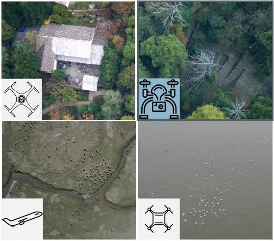
We evaluated the health of ancient Heritiera littoralis communities in landward terrestrial, seaward terrestrial, and halophytic marsh habitats using UAV remote sensing combined with ground surveys. Remote sensing indicators such as canopy height, forest window characteristics, photosynthetic effective radiation cross section ratio, Normalized Difference Vegetation Index (NDVI), Nitrogen Reflection Index (NRI), Yellow band Index (YI), and Forest Health Index (FHI) were used to indicate the health of ancient H. littoralis communities. The sky-ground combined survey indicated that: 1) Ancient H. littoralis tree holes were larger and more common in the halophytic marsh habitat due to their age. Moreover, the halophytic marsh habitat had the lowest biodiversity, with the highest biodiversity found in the seaward terrestrial habitat. 2) The lowest canopy height was found in the halophytic marsh habitat, with few large canopy gaps and the lowest shape complexity and photosynthetic effective radiation cross section ratio. The above indexes displayed little difference between the landward and seaward terrestrial habitats. NDVI, NRI, YI, and FHI values all tended to be lower in halophytic marshes than in landward and seaward terrestrial habitats, with no significant difference between the landward and seaward terrestrial habitats. 3) The UAV remote sensing survey results exhibited good correlation with the ground survey results, objectively reflecting the health of ancient H. littoralis communities in different habitats. After further improvements for specific communities, the evaluation system based on UAV remote sensing could be a rapid, non-destructive, and quantitative method for diagnosing ancient tree health.
Use of Unmanned Aerial Vehicles (UAVs) to monitor waterfowl at a high spatial-temporal resolution and mobility offers enormous advantages by not only expanding the scope of monitoring but also the accurate identification of different species. However, due to its flexibility in movement, the UAV can easily move closer to the target and can impact the birds. In this study, in order to build a UAV waterfowl monitoring mode that is reasonable and orderly, a multi-rotor UAV, DJI Mavic 2 Pro (weight 907 g) was used to monitor the wintering waterfowl in the Napahai Wetland, a Ramsar site in Northwest Yunnan, China. The waterfowls were broadly divided into three categories according to their body size as: 1) big-sized birds with body lengths of 80-120 cm, 2) medium-sized birds with body lengths of 40-80 cm, and 3) small-sized birds with body lengths less than 40 cm. Using the multi-rotor UAV at different flight heights and camera shooting angles, three flocks, namely the black-necked crane (Grus nigricollis) as the typical species representing big-sized birds, the mallard (Anas platyrhynchos) as the typical species representing medium-sized birds, and the common size of coot is less than 40 cm. It has different traits with the ducks. And it has a large population in the study area, were monitored and results were compared. During the course of the monitoring process we recognized that multiple factors influenced the study results. The factors that influenced monitoring include the following: The distinguishability of the camera was a decisive factor in the identification of the species, but this factor is relatively insignificant while using the multi-rotor UAV camera. Second, although the fixed wing UAV has a high-resolution camera, it is unable to stop midair or adjust its altitude quickly. Also, it requires a proposed flight path. Third, waterfowl behavior was influenced by the type of UAV including its size, weight, flight height, and noise, apart from the monitoring time. It is difficult to quantify the effect as these factors have a compound effect. Fourth, automatic identification based on UAVs and the image recognition of waterfowl requires large datasets of images of birds from the top view, whereas regular images mostly comprise the side view. The top view images mainly provide features of the waterfowl’s back, while the side view angle mainly provides features of waterfowl’s head, chest and wing. Fifth, when the waterfowl cluster is large, several images may be required to cover the whole cluster and these images need to spliced into a big image. The high overlap rate of the images may cause major errors while arriving at the final population of the birds. We have summarized some of the prerequisites for UAV waterfowl monitoring as follows: 1) the UAV should be light and small to ensure that waterfowl do not mistake them for predators; 2) the UAV must be flown at a lower altitude and an appropriate speed without disturbing the waterfowl cluster to fly; 3) smooth and stable operation should be ensured as the UAV approaches the waterfowl colony; 4) the monitoring time must be minimized when the UAV is close to the waterfowl, and in case of extended monitoring, the UAV should be kept away from the waterfowl cluster (use of the telephoto lens is recommended); and 5) the selection of monitoring time periods and areas for waterfowl using UAV should be based on a complete understanding of the target colony because different species respond differently to various kinds of disturbances at various times and in different habitats.
Forest canopy plays a significant role on community biodiversity maintenance, which is the key eco-boundary of forest atmosphere interactions. As an indicator of canopy dynamic, gap is one of the most important factors in maintaining the long-term transformation of ecosystems. In recent times, biodiversity monitoring has been the focus of much attention and study. As such, the problem of how to accurately describe gap features such as size and distribution requires urgent resolution. Furthermore, it is necessary to combine these features with monitoring data from permanent plots in forests in order to bring about solutions for issues relevant to community construction. These solutions will also help researchers achieve a better understanding of the maintenance system of community species diversity in forests. In this study, a practical canopy gap monitoring system was formed on the basis of different image extraction methods using lightweight Unmanned Aerial Vehicles (UAV) and a Geographic Information System (GIS). A 20 ha permanent monitoring plot in Dinghushan, classified as subtropical forest stand in South China, was selected as the data source. The results obtained from different gap extraction methods were scientifically analyzed after a strict classification. Results indicated that the red, green, and blue (RGB) band image classification was applied as the method of extracting remotely sensed images in the monitoring system built in the study. The extracted results were significantly similar to precise field measures. We emphasized penetrability of canopy as a whole in order to quantify the concept depths of the forest gap in subtropical forest stands; we confirmed that the gap could be established in only the lowest height of the canopy. The gap accuracy of supervised classification based on the DJI Phantom UAV was 72.3%, a value lower than the 98.7% attributed to the MD4-1000 UAV. The MD4-1000 is able to fly at specific heights according to geographic states and retrieve relevant tree height data; however, the cost of its use need to be considered. The differences in data obtainment between extraction and actual measurement will also increase while the gradient of plot rises. Therefore, the DJI Phantom UAV is considered suitable for large plot gap extraction due to its accuracy and high efficiency and despite its low-resolution ratio and decreased mission function. Nonetheless, a total of 2 706 individuals and 17 species were identified by MD4-1000 UAV. A high-resolution drone is available for partial species identification based on reduced flight altitude. This paper therefore indicates that monitoring forest canopies of permanent plots by using UAV on the basis of near-ground remote sensing is able to provide a database for study in community assembly. It is expected that species diversity maintenance can also be investigated by the inclusion of variants in our study perspective. t is expected that the inclusion of variants in our study perspective could provide further database for study in forest community assembly. Hopefully species diversity maintenance could be investigated by new perspective of near-ground remote sensing.
Unmanned Aerial Vehicle Remote Sensing (UAVRS) has the features of real time, flexibility, and low cost. It has been extensively used in monitoring crop nutrition and precision agricultural management. Litchi is a tropical fruit with the largest planting area, the most distinctive variety characteristics, the most obvious regional advantages, and the longest planting history in South China. Its yields are low and unstable. Nutrition diagnosis and fertilization technology as the main factors restricting the yields and quality of litchi have been research hotspots of agricultural precision management. Using litchi in the flower bud differentiation stage as an example, litchi orchards in Huizhou City, Guangdong Province, were monitored using a UAV with a Parrot Sequoia multispectral camera, and the spatial distribution differences of nutrient content in the canopy leaves were analyzed. Eighteen spectral variables were selected for the study, and the spectral variables and leaf nutrient mass fraction were analyzed by correlation analysis. A regression equation between the vegetation index and nutrient mass fraction was established by screening the correlation relationship between leaf nutrient mass fraction and vegetation index with significant and high correlations. The stability of an Residual Prediction Deviation (RPD) comprehensive evaluation model with determination coefficient, cross-validation determination coefficient, and prediction residual, as well as the relationship between the leaf nutrient mass fraction and vegetation index in different canopy layers of litchi were all discussed. The system and its influence on a UAV multi-spectral remote sensing monitoring model were examined. The results revealed the following. 1) The leaf nitrogen and potassium contents in different canopy layers of litchi increased significantly with a decrease in canopy height, particularly the spatial distribution of potassium. 2) The nitrogen mass fraction of the upper and middle leaves of the canopy was significantly correlated with the Carotenoid Reflectance Index (CRI) index as calculated by orthophoto data. The correlation between the nitrogen mass fraction in the upper leaves and CRI was significant (r=0.86, p<0.01). The potassium mass fraction in the middle and lower leaves of the canopy was significantly correlated with the multispectral parameters, namely, Normalized Green (NG) and Normalized Near Infrared (NNIR), of orthophoto data derived from the UAV. Of these parameters, the middle potassium mass fraction was significantly correlated with the spectral variable NNIR (r=-0.80, p<0.01) and the lower leaf mass fraction had the highest correlation with the NG index (r=-0.83, p<0.01). This indicated that the UAV multispectral data had the potential to estimate the changes in nitrogen and potassium mass fraction in litchi leaves of different layers. 3) The vegetation index CRI could effectively retrieve the nitrogen quality fraction of litchi upper and middle layers. The upper layer nitrogen model R2, and RPD were 0.74, 0.57, and 1.50, respectively. The middle layer nitrogen model R2, R2CV and RPD were 0.64, 0.44, and 1.40, respectively. NNIR, NG, and other spectral parameters could better retrieve the potassium quality fraction of litchi upper and lower layers, where the upper layer nitrogen model R2, R2CV and RPD were 0.64, 0.44, and 1.40, respectively. The potassium model R2, R2CV and RPD in the middle layer were 0.79, 0.56 and 1.50, respectively. The potassium model R2, R2CV and RPD in the lower layer were 0.69, 0.55, and 1.70, respectively. The model accuracy of the nutrient mass fraction in the full canopy was also higher (R2> 0.70,R2CV > 0.50, and RPD > 1.4), indicating that the spatial variation of the nutrient mass fraction in the litchi canopy leaves was based on vertical remote sensing data. The accuracy of the model for estimating the leaf nutrient content was affected. The application of UAV multi-spectral remote sensing image data can monitor litchi nutrient content very well and provide information support for precise fertilization management of litchi orchards, which has important research significance and application value.
The images of yam plantation areas were collected by the four-rotor unmanned aerial vehicle (UAV). Aiming at different characteristics of the yam plant growth caused by diverse planting times and management levels, the optimal color index calculation method was obtained by screening Red-Green Ratio Index (RGRI), Excess Green Index (ExG), Excess Green Minus Excess Red Index (ExG-ExR), and other color indexes. Gaussian High-Pass Filter (GHPF) was used to enhance and retain high-frequency information of yam plants and inhibit the noise from weeds and corn plants. Combined with field measurement of yam plants, grayscale segmentation and extraction of yam plant information were performed on the data after image filtering and image enhancement via a human-computer interaction interpretation method. The results show that: 1) the method has high yam plant identification and plant number calculation accuracy. The overall average extraction accuracy of the sample areas is 91.14%, and the extraction accuracy of sample area A, sample area B, and sample area C is 90.94%, 91.96%, and 90.81%, respectively. The extraction accuracy of the image for accuracy verification integrity is 93.16%. 2) With the increasing complexity of multiple conjoined growth of yam plants, the soil and vegetation separation of ExG is still superior to that of RGRI and ExG-ExR. Soil and vegetation separation gradually decreases while calculating RGRI, while the plant pattern spots gradually expand into one pattern spot. In the calculation of ExG-ExR, the soil and vegetation separation decreases with an increase in the complexity of multiple conjoined plants. In addition, the calculation method of ExG-ExR considerably contributes to the DN (Digital Number) value of weeds and corn plants. The DN value of weeds and corn is similar to that of yam plants, which is not conducive to the identification of the latter. 3) GHPF method has a good enhancement effect on the high-frequency information of the yam plants; the mean, range, and standard deviation, respectively, transform from 3.2044 to -0.0198, 181 to 121, and 25.5886 to 15.9735, and the weeds and corn plants are effectively inhibited. Thus, the use of GHPF can effectively eliminate the effects of weeds and corn plants, and reduce the interference caused by the multiple conjoined growth of yam plants. The yam plant identification and extraction method using ExG, GHPF, and Individual Crop Area Method can effectively eliminate the influence of weeds and reduce the interference caused by the growth of multiple yam plants; 4) The nucleus size 79×79 of GHPF is suitable for image processing of yam plants at different time phases and under different growth conditions. For visible light images of yam plants under different growth conditions and different growth phases, it is necessary to adjust the threshold parameter t of gray scale segmentation, and determine the area S of individual yam plant by field measurements. The method identifies and calculates the number of yam plants in various stages of growth states in a fast, flexible and low-cost manner, which is suitable for precision agricultural monitoring research and modern agricultural production activities in karst mountainous areas.
The net primary productivity (NPP) of vegetation is an important component of the carbon cycle and carbon budget balance in global ecosystems. Its accurate assessment depends on high-resolution satellite data. Previous studies have mostly estimated NPP using remote sensing data from moderate resolution imaging spectroradiometers (250-8000 m) and thematic mappers (30 m). Due to the limitations and influences of spatial resolution and weather factors in the Beibu Gulf, it is difficult to accurately assess the NPP of mangrove and archipelago ecosystems. This study is the first to use aerial images from unmanned aerial vehicles (UAV) as a data source and to use the CART method in ENVI5.3 to interpret the landscapes of mangrove and archipelago ecosystems. Using python language, the CASA model was implemented and introduced in our study to obtain spatial NPP distribution characteristics in different islands and mangrove ecosystems. We found that: 1) The VDVI index ranged from -1 to 1 and its vegetation index form was similar to the normalized differential vegetation index (NDVI). The threshold value for vegetation and non-vegetation segmentation was 0, which should be selected as the input parameter for the vegetation index in the CASA model. 2) The NPP carbon density in the study area ranged from 0 to 1437.12 g·C/m2, with an average value of 399.85 g·C/m2. NPP spatial distribution was divided by the mangrove ecosystem in the north and Guixian island in the south. The NPP of the mangrove ecosystem in the north was higher than that of the south. 3) The seasonal order of NPP carbon density was as follows: summer (191.35 g·C/m2) > autumn (116.55 g·C/m2) > spring (62.98 g·C/m2) > winter (28.94 g·C/m2). The percentage of the average annual NPP for each season was 47.86%, 29.15%, 15.75%, and 7.24%, respectively. 4) The maximum carbon density per unit area of mangrove ecosystem in the study area was 545.56 g·C·m-2, followed by Leeward Pier Island (535.90 g·C/m2), whilst Guixian Island was the lowest with a value of 413.54 g·C·m-2. The average NPP carbon density in typical mangrove and archipelago ecosystems estimated by this method was similar to the national average, lower than that of coastal provinces on the same latitude, but higher than that of provinces such as Hunan and Yunnan. The results of this study provide a reference and basis for further small-scale studies of NPP and its rapid estimation and also provide a new international research perspective. In the future, the Li-6400XT portable photosynthesis measurement system could be used to determine the maximum light use efficiency of different vegetation types to examine the NPP of mangroves in island groups and accurately assess the model. At the same time, high resolution satellite data and UAV data could be used to combine spatial and temporal data, thus improving both the spatial resolution and range of the vegetation index.
Oblique photograph technique can realize the modeling and texture acquisition of the top and side facades of the object simultaneously, and can generate a three-dimensional model more accurately than traditional orthophoto photography. Using the UAV oblique photograph technology, the previous, rear, left, right, and positive five flight routes were dynamically monitored in 13 sub-cavities in Qianqian Village, Deqing County, from 2016 to 2017. A total of 6 189 photographs were collected. Using Pix4Dmapper software for air triangulation, orthophoto images and DEM data were generated. TerraSolid software was used for filtering and classification of point cloud data to reduce the impact of vegetation on DEM accuracy. Using ArcGIS software for spatial analysis, quantitative parameters of the slope including slope direction, and different elevations of the collapse, were evaluated in order to determine the distribution of the collapse in time and space. The results show that: 1)Compared with 2016,the total area of collapse erosion in 2017 increased by 16 401.2 m2, with a change rate of 10.21%. This indicates that the collapse in the study area are still developing. 2) In the area with slope less than 40 degrees, the area of collapse in 2017 is larger than that in 2016, and the area of collapse in the range of 0-10 degrees increases the most. The area with the slope of 41 degrees to 80 degrees is just the opposite. 3) the area of collapse is the largest in SE-SW, and the slope of the collapse area in 2016-2017 is primarily located in S-SW, of which the slope area facing SSW is the most obvious, accounting for 21.98 % of the total reduction of the area of collapse. The slope with the most serious overall erosion was concentrated in the south; 4) the most strongly eroded parts are found at elevations of 51–60 m and 81–90 m; the reason for this is that the slope of this section is below 60°, indicating a strong runoff erosion ability Moreover, the slope is long and high, and is prone to collapse. At the elevation of 41-50 m, the volume of collapse in 2017 is larger than that in 2016, results from an increase in the thickness of the accumulation area; 5) The annual erosion volume amount of landslide material in the study area is 1 172.68×10³ m3 for the two years studied. The quality of Unmanned Aerial Vehicle(UAV) measurement data can meet the specification requirements of UAV photogrammetry. It can be seen that the UAV oblique photograph technology is more accurate, more convenient, and less expensive than the traditional investigation methods. It can be applied to a wide range of erosion monitoring studies, and has broad application prospects in geological surveys and soil and water conservation planning.
The foundation of ecological civilization construction is the acquisition of ecological remote sensing data. Traditional ecological data obtained on the basis of ground surveys are time-consuming, laborious, and cannot meet the requirements of large-scale data. However, satellite remote sensing data is inconvenient in obtaining ecological data in real time due to resolution and cycle problems. In recent years, light, small Unmanned Aerial Vehicles (UAV), offering advantages of high flexibility and high resolution, have played an important role in the fields of agriculture, environment ecology, and remote sensing, subsequently becoming the backbone of ecological research. This paper summarizes the application potential of UAV remote sensing in ecological research from the aspects of research object, research scale, and ecological trend, both analyzing the advantages and limitations of different ecosystem applications and discussing the application trend of UAV remote sensing in ecological research in the future. As a result of software and hardware problems such as data standardization and endurance, UAV applications still have some limitations. With the trends of intelligent software and hardware for UAV and the background of ecological big data, the acquisition and processing of UAV data will become more comprehensive, flexible, rapid, and intelligent in the future; as a result, the emerging UAV remote sensing data will be able to better serve ecological research. The application trend of UAV remote sensing in ecological big data can be summarized in three aspects: scaling, sampling, and synergy. The use of UAV has not been able to achieve scale due to its hardware limitations; therefore, expanding its scope of operation is both a great challenge and an important application direction. Sampling can help researchers obtain information from a small sample square and estimate the corresponding regional information by referring to the sample square. Synergies, including cloud storage, multi-source data fusion, scientific data classification, and data standardization processing can help researchers use data effectively. With the wide applications of multi-source data fusion, UAV data will also be widely used in ecological remote sensing surveying, providing important data support for ecosystem status, ecological stability, biodiversity assessment, ecosystem monitoring, ecosystem management, as well as other related aspects in the future. At the same time, as the new data brought by the UAV has a specific resolution and scale, the traditional data indicators are no longer applicable. In order to make better use of UAV data, the establishment of new indicators of UAV data is also an urgently pending task. The 21st century is the era of information and big data; with the development of science, technology, and society, new technologies emerge in an endless stream. Through research of cutting-edge theories such as artificial intelligence ecology, ecological big data, ecological prediction, as well as the establishment of new indices of UAV data, new technologies will be able to better serve ecology.
Unmanned aerial vehicles (UAVs) have brought technological changes and development opportunities for research in the field of ecological monitoring by remote sensing. Over the past ten years, international scholars have actively conducted research in this field and published many papers, but there have been few reports on the overall development process and research progress in this field. Based on the relevant literature in the Web of Science database between 2004 and 2018, this study analyzed the number of annual papers, authors, countries, institutions, periodicals, keywords, etc., by means of bibliometric statistics and visualization. From the bibliometric perspective, the development process and research progress of international UAV ecological remote sensing monitoring are evaluated. The results show that 381 documents in this field are from 1598 scholars from 646 institutions in 62 countries. From 2004 to 2012, a total of 29 papers were published, with an average of 3.22 articles per year. The number of documents grew slowly. A total of 352 articles were published from 2013 to 2018, with an average of 58.67 articles per year, which shows the explosive growth of the volume of publications. With the advancement of remote sensing technology, UAV remote sensing has become widely used in ecological monitoring. Zarco–Tejada P J (9 papers), Lucieer A (8 papers), and Lopez–Granados F (7 papers) are the top three scholars in the field. USA (101 papers), China (66 papers), and Spain (43 papers) have the greatest comprehensive research strength. The United States Department of Agriculture (24 papers), Spanish National Research Council (24 papers), and Chinese Academy of Sciences (19 papers) lead the world in terms of publications. Although there are many scholars around the world engaged in research in this field, there are relatively few academic exchanges and cooperation between international scholars. Remote Sensing, International Journal of Remote Sensing, and Precision Agriculture are the main journals that publish the literature in this field. In addition to the keywords (unmanned aerial vehicle, drone) used for searching, keywords such as precision agriculture, vegetation indices, and forest inventory are used with high frequency. This result shows that the application of UAV remote sensing in precision agriculture and vegetation survey has always been the focus of research in this field. UAV remote sensing has been applied to monitoring research in many ecological fields in China, and is in a leading position in the world. In order to promote the research on UAV ecological remote sensing monitoring, strengthening exchanges and cooperation between scholars at home and abroad, enhancing technological innovation, and broadening the scope of applications of the field of ecological monitoring are recommended.