×
模态框(Modal)标题
在这里添加一些文本
Close
Close
Submit
Cancel
Confirm
×
模态框(Modal)标题
×
Journal
Article
Figure
Search
EN
中文
Home
About Journal
About Journal
Indexed in
Awards
Editorial Board
Guide for Authors
Browse
Current Issue
Online First
Archive
Highlights
Topic
Archive by Subject
Most Viewed
Most Download
Most Cited
E-mail Alert
RSS
Subscribe
Topic
Contact us
EN
中文
Figure/Table detail
Disaster Resilience Evaluation of Mountainous Rural Communities: A Case Study of Representative Villages in the Anning River Basin, Liangshan Prefecture
Yuanfei Wu, Mengying Liu, Bingwei Tian, Renjie Tian, Yifan Hu
Tropical Geography
, 2025, 45(
4
): 704-718. DOI:
10.13284/j.cnki.rddl.20240758
Fig.9
Caogu village key control area of debris flow
Other figure/table from this article
Table 1
Basic situation of typical rural communities
Fig.1
Geographical location of 4 typical rural communities
Table 2
Detailed data sources
Fig.2
The relationship of "pressure-state-response" in PSR model
Fig.3
Disaster resilience cognitive framework of rural communities based on PSR mode
Table 3
Toughness characteristics correspond to each dimension of "pressure-state-response"
Fig.4
Hierarchical structure of disaster resilience evaluation system in rural communities
Table 4
Disaster resilience evaluation index system of mountainous rural communities
Table 5
Resilience level scores of each element layer in typical rural communities
Fig.5
Typical rural community resilience score statistics
Fig.6
Disaster prevention and mitigation planning paths for mountainous rural communities
Fig.7
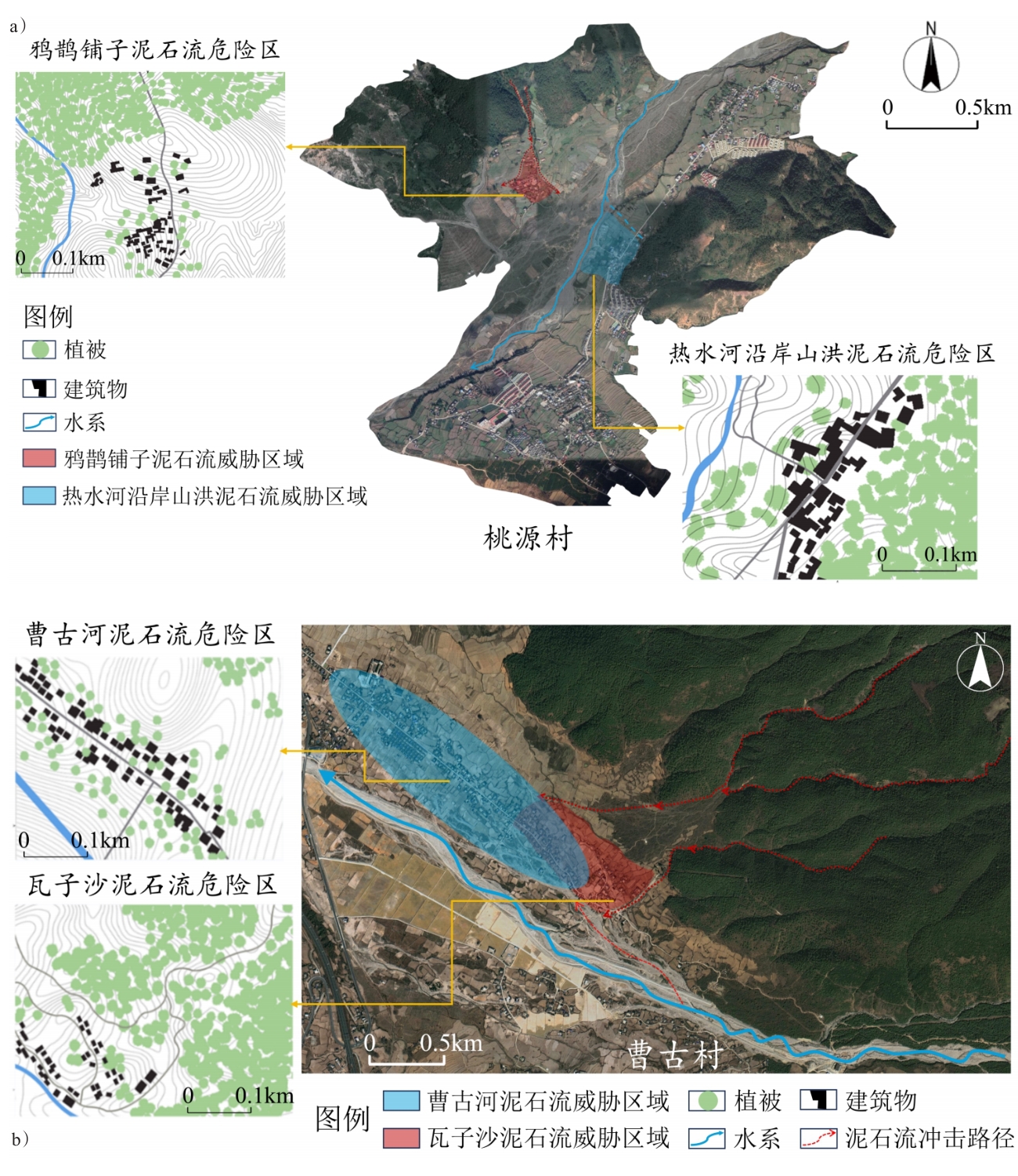
Relationship between debris flow hazard areas and residential buildings distribution (a. Taoyuan Village; b. Caogu Village)
Fig.8
Disaster prevention zone of the Taoyuan village